Fidènes VIe et IVe siècles avant JC.svg
From Warlike

Size of this PNG preview of this SVG file: 673 × 600 pixels. Other resolutions: 269 × 240 pixels | 539 × 480 pixels | 862 × 768 pixels | 1,149 × 1,024 pixels | 2,298 × 2,048 pixels | 882 × 786 pixels.
Original file (SVG file, nominally 882 × 786 pixels, file size: 1.97 MB)
Summary
| Description |
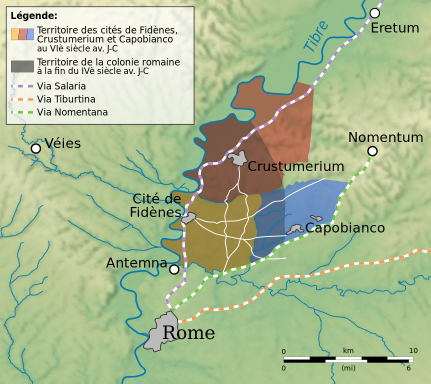
Français : Emprise de la colonie romaine sise sur les territoires des cités de Fidènes, Crustumerium et Capobianco. |
| Date | |
| Source |
Données hydrographiques : OpenStreetMap (depuis GeoFabrik) |
| Author | Flappiefh |
Licensing
I, the copyright holder of this work, hereby publish it under the following licence:
This file is licensed under the Creative Commons Attribution-Share Alike 3.0 Unported licence.
- You are free:
- to share – to copy, distribute and transmit the work
- to remix – to adapt the work
- Under the following conditions:
- attribution – You must give appropriate credit, provide a link to the licence, and indicate if changes were made. You may do so in any reasonable manner, but not in any way that suggests the licensor endorses you or your use.
- share alike – If you remix, transform, or build upon the material, you must distribute your contributions under the same or compatible licence as the original.
File history
Click on a date/time to view the file as it appeared at that time.
| Date/Time | Thumbnail | Dimensions | User | Comment | |
|---|---|---|---|---|---|
| current | 11:32, 20 January 2013 | | 882 × 786 (1.97 MB) | wikimediacommons>Flappiefh | User created page with UploadWizard |
File usage
The following 5 pages use this file: