Drake's Island
From Warlike
Q1255576
Drake's Island is a 6.5-acre (2.6-hectare) island approximately 500 metres from land in Plymouth Sound, the stretch of water south of the city of Plymouth, Devon. The rocks which make up the island are volcanic tuff and lava, together with marine limestone of the Devonian period. For more than 400 years the island was fortified.
Website,
Wikimedia, Wikidata
Plymouth Palmerston Forts, British Isles,

Location: 50.3556, -4.1536, KML, Maps
3 places
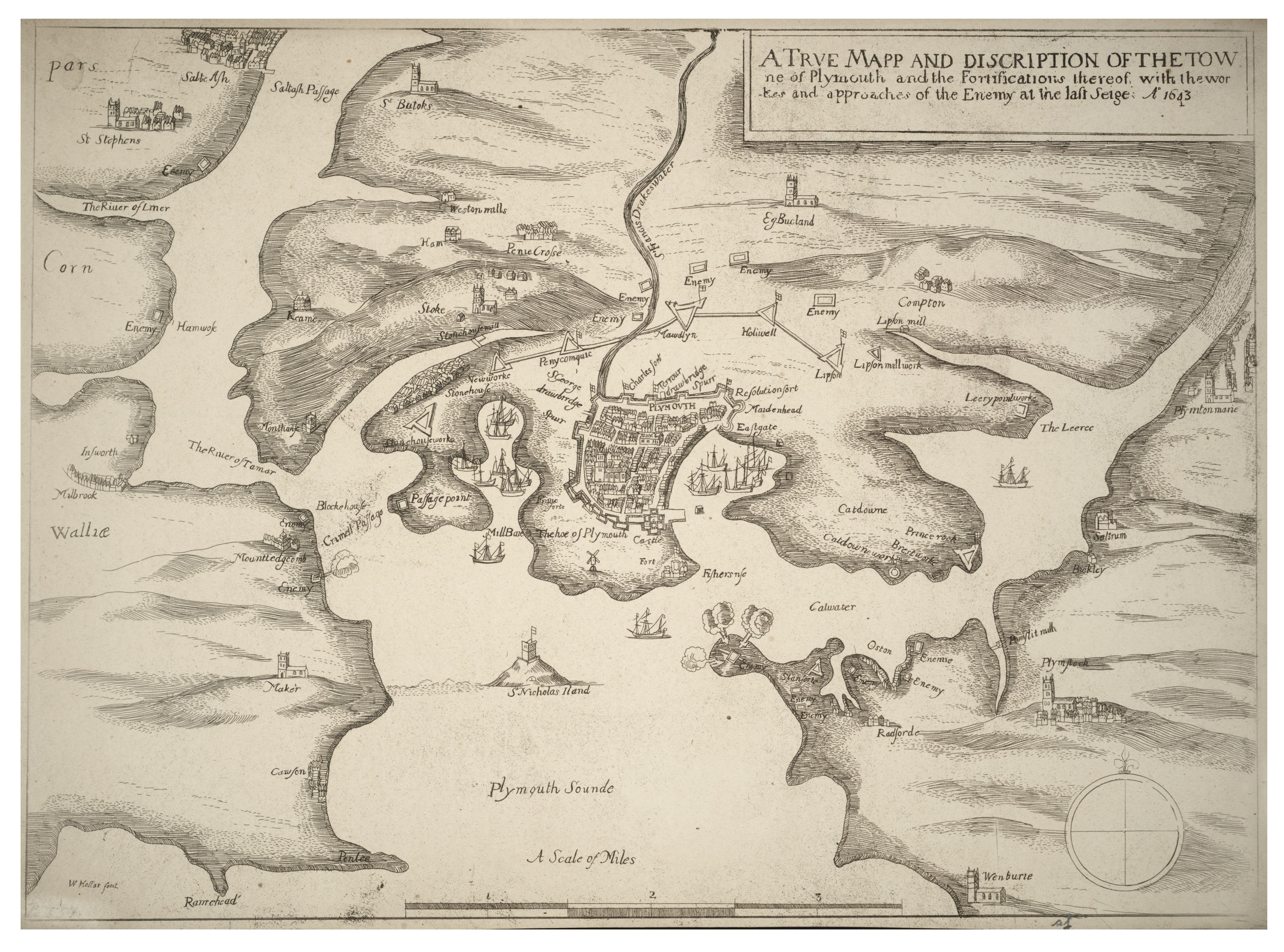 Wenceslas Hollar - Siege of Plymouth
 A view of Plymouth Fort and St. Nicholas's Island from Mount Edgcumbe (NYPL b13512827-423126)
 The Pier, with Drake's Island, Plymouth, England-LCCN2002708047
 Drake's Island, Plymouth RMG RP6501
 EW(1884) p.191 - Plymouth, Devenport and Stonehouse - A + C Black (pub)
 Gezicht op Plymouth vanaf Mount Edgcumbe Angleterre. Défense des côtes. Reconaissance de 1891. Photographies (serietitel), RP-F-2000-126-29
 Mount Edgcumbe Folly
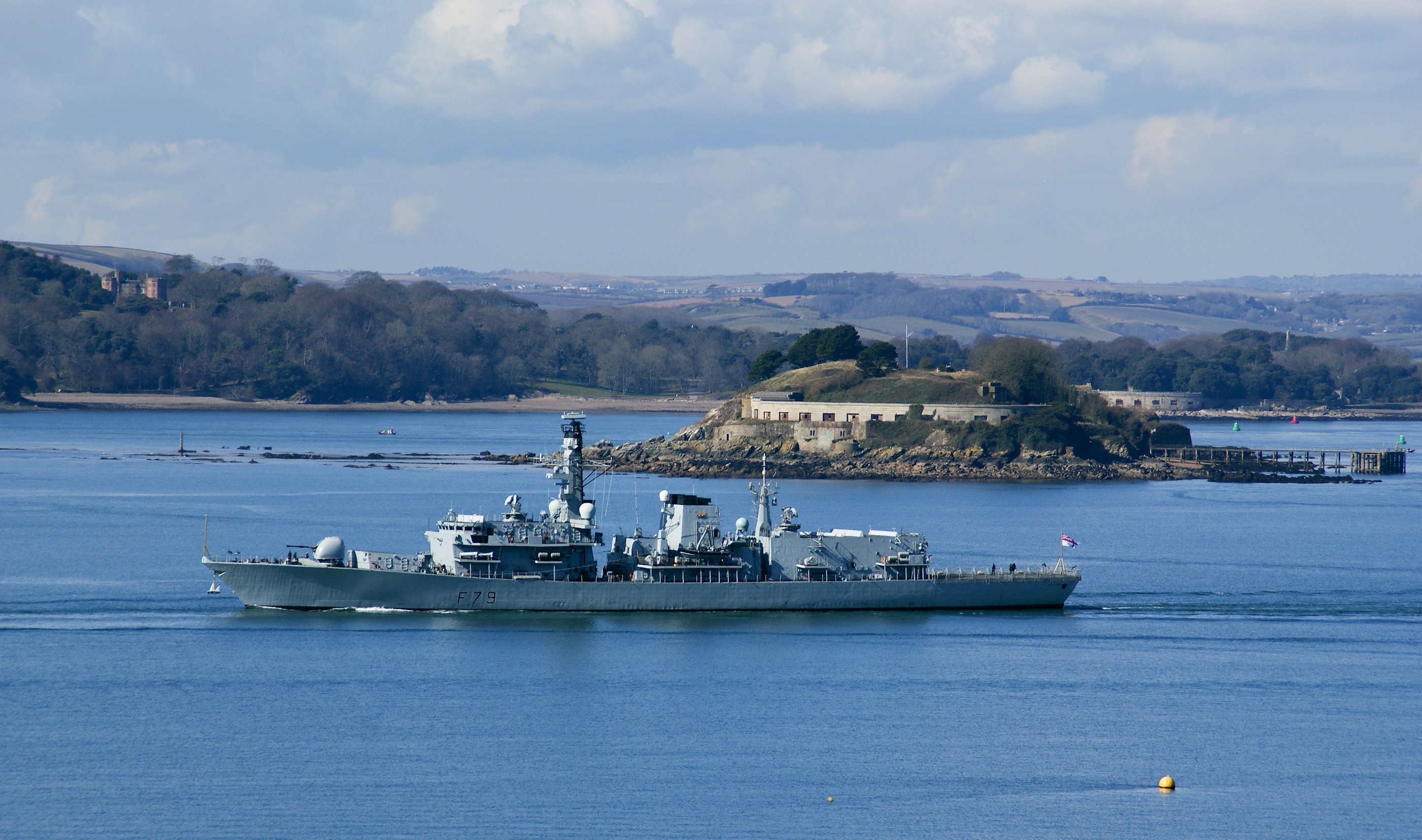 F79 at Drakes island P sound
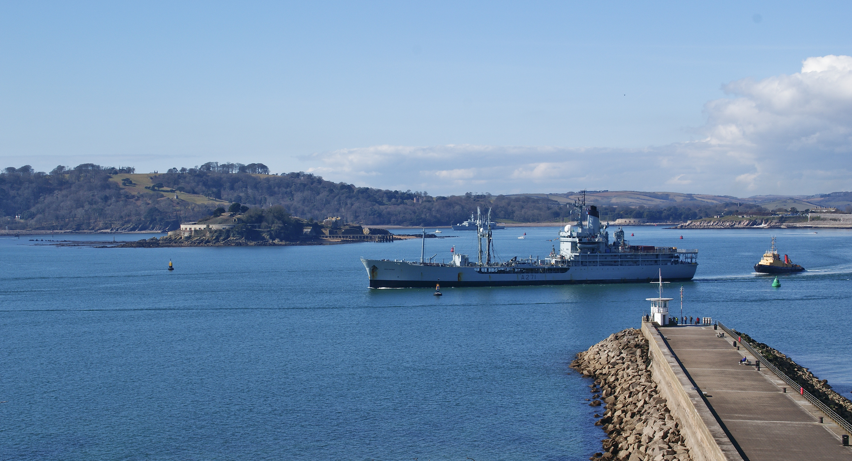 RFA Gold Rover (A271) P sound
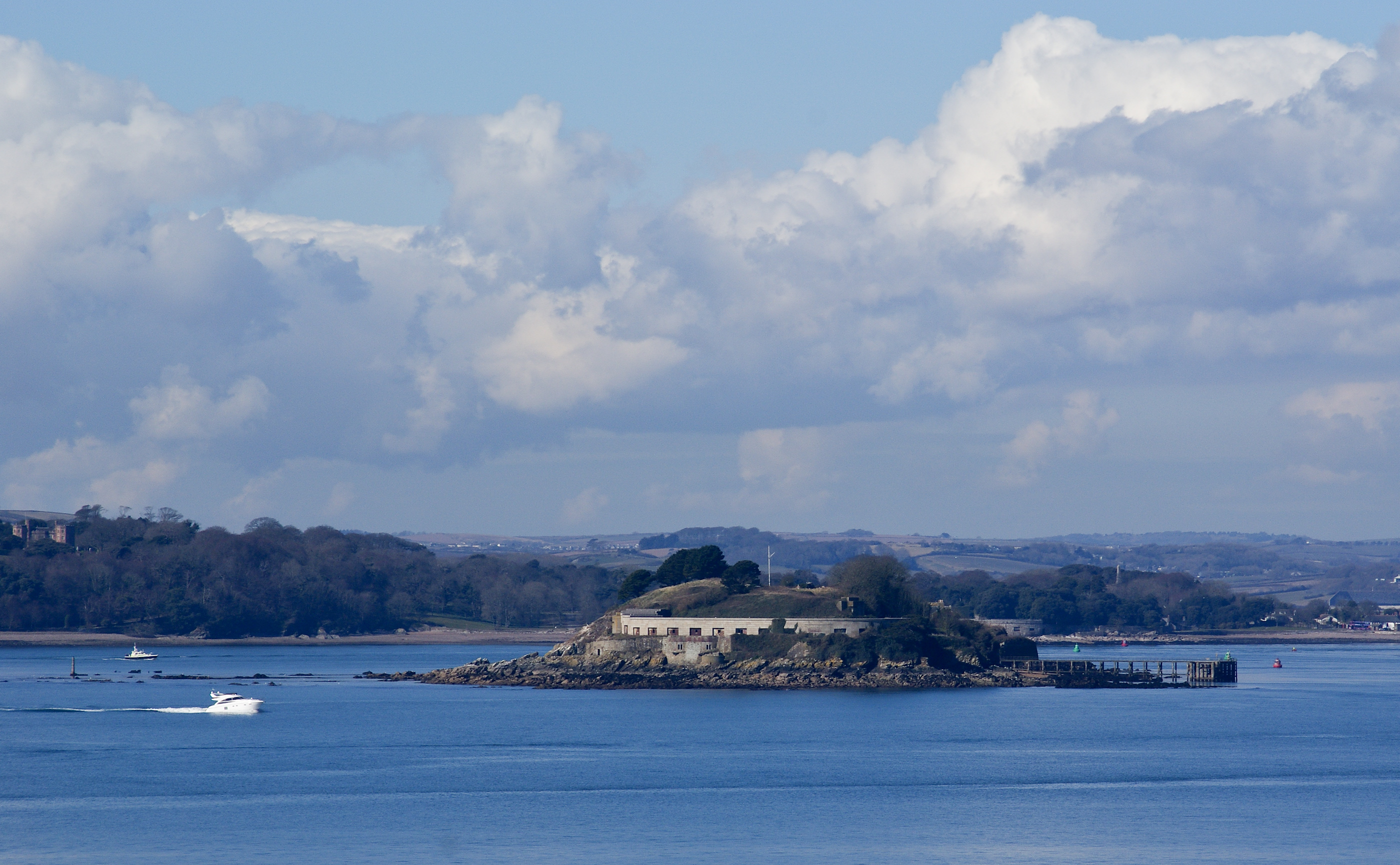 Drakes island P sound
| Type | Subtype | Date | Description | Notes | Source |
|---|---|---|---|---|---|
| link | page | Sketchfab page@ | Wikidata | ||
| link | page | Tripadvisor page@ | Wikidata | ||
| link | page | Victorian Forts and Artillery page@ | Wikidata | ||
| commons | image | Wenceslas Hollar - Siege of Plymouth | Commons | ||
| commons | image | A view of Plymouth Fort and St. Nicholas's Island from Mount Edgcumbe (NYPL b13512827-423126) | Commons | ||
| commons | image | The Pier, with Drake's Island, Plymouth, England-LCCN2002708047 | Commons | ||
| commons | image | Drake's Island, Plymouth RMG RP6501 | Commons | ||
| commons | image | EW(1884) p.191 - Plymouth, Devenport and Stonehouse - A + C Black (pub) | Commons | ||
| commons | image | Gezicht op Plymouth vanaf Mount Edgcumbe Angleterre. Défense des côtes. Reconaissance de 1891. Photographies (serietitel), RP-F-2000-126-29 | Commons | ||
| commons | image | Mount Edgcumbe Folly | Commons | ||
| commons | image | F79 at Drakes island P sound | Commons | ||
| commons | image | RFA Gold Rover (A271) P sound | Commons | ||
| commons | image | Drakes island P sound | Commons | ||
.jpg)
_p.191_-_Plymouth,_Devenport_and_Stonehouse_-_A_%2B_C_Black_(pub).jpg)
,_RP-F-2000-126-29.jpg)
_P_sound.jpg)