New Netherland
From Warlike
New Netherland, also called the New Netherlands, was a colony of the Dutch Republic located on the East Coast of what is now the United States. The claimed territories extended from the Delmarva Peninsula to Cape Cod. Settlements were established in what became the states of New York, New Jersey, Delaware, and Connecticut, with small outposts in Pennsylvania and Rhode Island.

1609-01-01T00:00:00Z
1667-01-01T00:00:00Z
1609 — 1667 New Netherland
{"selectable":false,"showCurrentTime":false,"width":"100%","zoomMin":100000000000}
 Indian Deed to Lubbertus van Dincklage to Purchase Staten Island July 10 1657 Part 2
 Indian Deed to Lubbertus van Dincklage to Purchase Staten Island July 10 1657 Part 1
 Nova Belgica Et Anglia Nova (New Netherland and New England) Blaeu Map c1634
 Cartographic document
 Stad Amsterdam in Nieuw Nederland (City Amsterdam in New Netherland) Castello Plan 1660
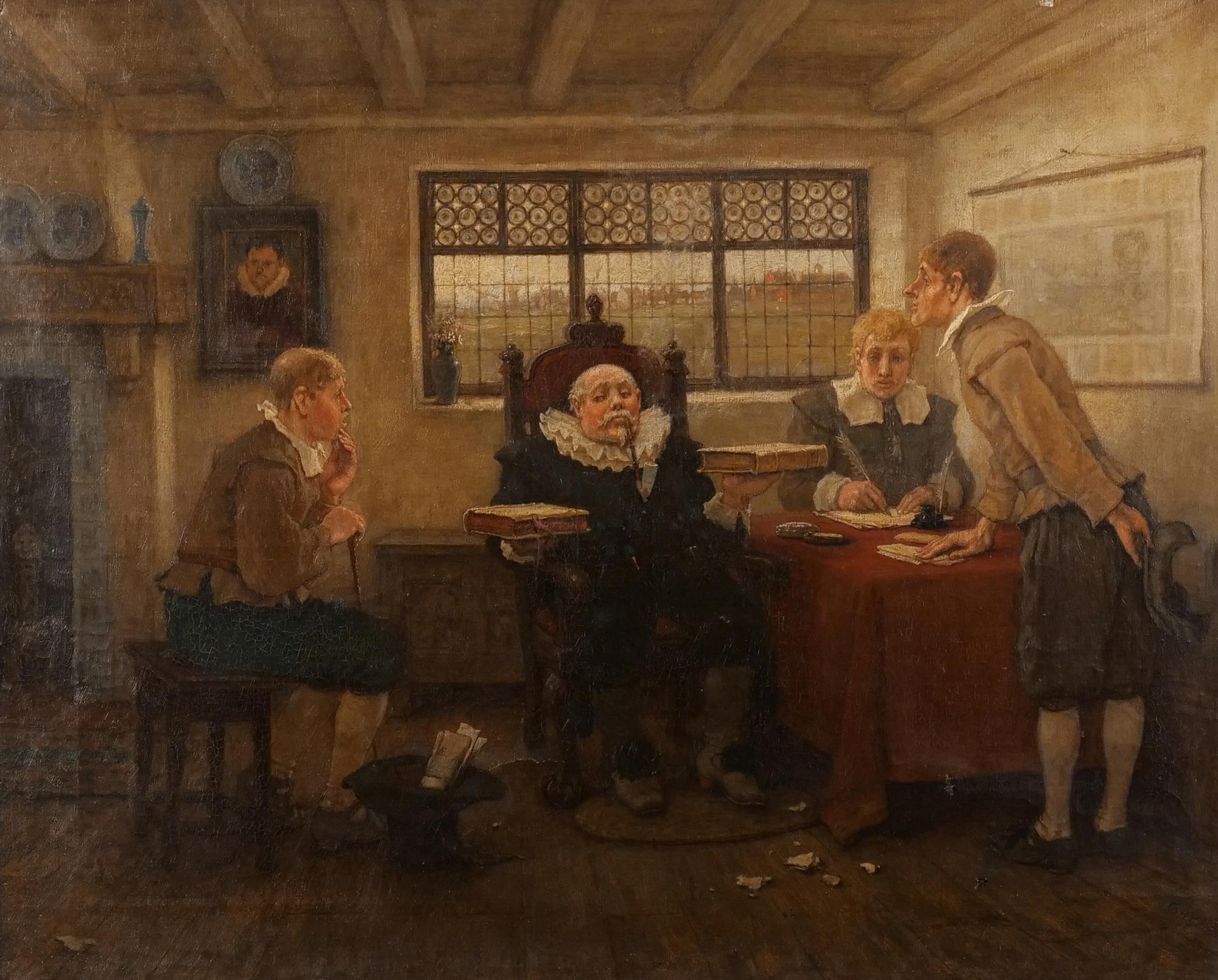 Wouter Van Twiller's Court New Amsterdam by George Henry Boughton
 Hudson Valley Map Detail Nova Belgica Et Anglia Nova c1634
 Map of New Netherland (Novi Belgii Novaeque Angliae) by Justus Danckerts c1673
 Cartographic document
 Cartographic document
- Description of the New Netherlands - 1655 Adriaen van der Donck publication, Dutch
- Template:Country data New Netherland - Wikimedia template
- Collier's New Encyclopedia (1921)/New Netherlands -
| Type | Subtype | Date | Description | Notes | Source |
|---|---|---|---|---|---|
| event | war | 1643 | Kieft's War | war, Mohawk, Lenape, Algonquian peoples, Wappinger, New Netherland, Raritan tribe, Mahican | Wikidata |
| commons | image | Indian Deed to Lubbertus van Dincklage to Purchase Staten Island July 10 1657 Part 2 | Commons | ||
| commons | image | Indian Deed to Lubbertus van Dincklage to Purchase Staten Island July 10 1657 Part 1 | Commons | ||
| commons | image | Nova Belgica Et Anglia Nova (New Netherland and New England) Blaeu Map c1634 | Commons | ||
| commons | image | Cartographic document | Commons | ||
| commons | image | Stad Amsterdam in Nieuw Nederland (City Amsterdam in New Netherland) Castello Plan 1660 | Commons | ||
| commons | image | Wouter Van Twiller's Court New Amsterdam by George Henry Boughton | Commons | ||
| commons | image | Hudson Valley Map Detail Nova Belgica Et Anglia Nova c1634 | Commons | ||
| commons | image | Map of New Netherland (Novi Belgii Novaeque Angliae) by Justus Danckerts c1673 | Commons | ||
| commons | image | Cartographic document | Commons | ||
| commons | image | Cartographic document | Commons | ||
_Blaeu_Map_c1634.jpg)
_Castello_Plan_1660.jpg)
_by_Justus_Danckerts_c1673.jpg)