Fort Pitt
From Warlike
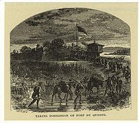
Fort Pitt was a fort built by British forces between 1759 and 1761 during the French and Indian War at the confluence of the Monongahela and Allegheny rivers, where the Ohio River is formed in western Pennsylvania. It was near the site of Fort Duquesne, a French colonial fort built in 1754 as tensions increased between Great Britain and France in both Europe and North America. The French destroyed Fort Duquesne in 1758 when they retreated under British attack.
1759 Website,
Wikimedia, Wikidata
United States, United States, 

Location: 40.4411, -80.009, KML, Cluster Map, Maps,
-

Battle of the Monongahela ⓘ
1755 battle of the French and Indian War -
Battle of Fort Duquesne ⓘ
1758 battle during the French and Indian War -

Siege of Fort Pitt ⓘ
1763 siege that was part of Pontiac's War -

Logan's War ⓘ
-

Fort Lafayette ⓘ
former fort in Pittsburgh, Pennsylvania -

Fort Duquesne ⓘ
colonial fort at the confluence of the Allegheny and Monongahela rivers in Pennsylvania -

Fort Pitt ⓘ
fort that was built at the Forks of the Ohio
-

USS Requin ⓘ
US Navy diesel-electric submarine (1945-1968)
 Old Fort Duquesne (i.e. Fort Pitt) LCCN2012645651
 Fort Pitt (Pennsylvania), map published in 1765
 Pittsburgh point of confluence
 Fort Pitt P6210238 Commanders quarters
 A Journey in North America, containing a survey of the countries watered by the Mississipi, Ohio, Missouri and other affluing rivers... illustrated by 36 maps, plans, views and divers cuts - by Victor Collot - btv1b530967428 (12 of 40)Fort Pitt (Pennsylvania), map published in 1765
 BASTIONS OF HISTORIC FORT PITT ARE MARKED BY A PLAQUE IN THE GATEWAY CENTER AREA OF DOWNTOWN PITTSBURGH, PENNSYLVANIA... - NARA - 557269
 Washington Pennsylvania Map
 (Braddock's route, 1755, Fort Cumberland to Fort Pitt. LOC gm71002325
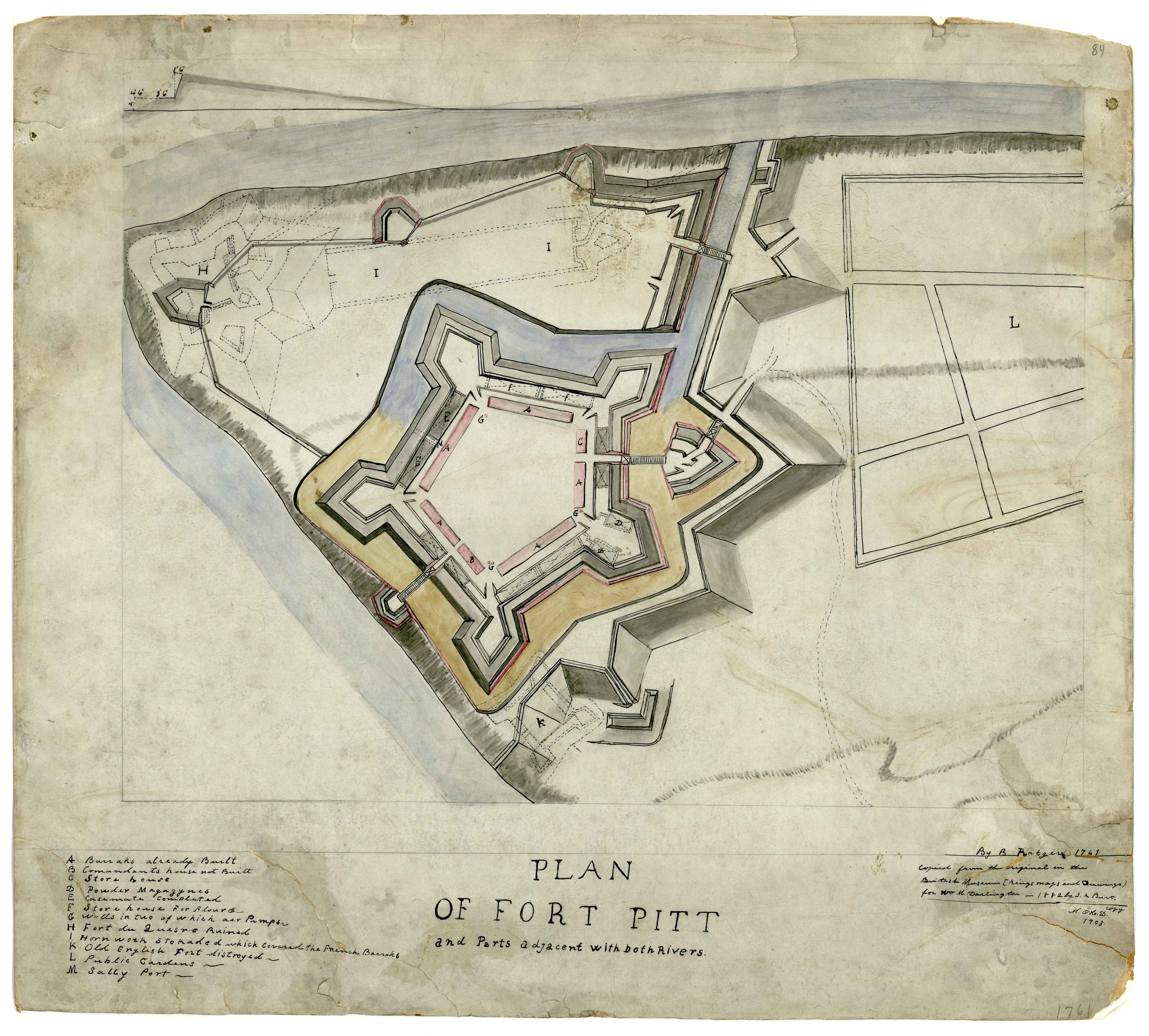 Plan of Fort Pitt, 1761
_LCCN2012645651.jpg)
.jpg)